Have you ever wanted to know what the current ground conditions of an area are currently like or what the weather has been like in an area in the past week, months, or even years? Maybe you are a scientist or researcher looking to get historical images of Earth or spectrographical data about Earth's atmosphere and surface.
NASA’s EOSDIS WorldView has every piece of data available that you can imagine for research. WorldView is a site that uses images and data from the EOSDIS to view historic satellite images and spectrography of Earth.
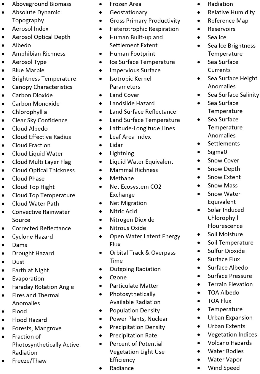
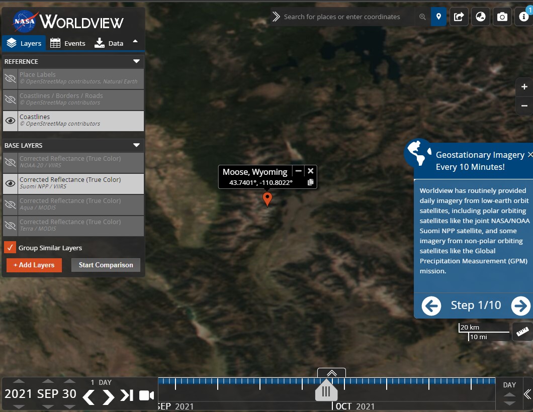
Here are all the different filtered layers of data you can acquire in WorldView
I usually use WorldView to view current and past weather conditions of areas before I travel. For example, if I want to go skiing or mountain climbing in a certain area, I will enter in the coordinates of the site and go through the past few weeks to look at snow cover. I will even look back a couple of years to look at the average snow cover during that time of year.
You can also see historic weather events and even the after math of hurricanes, tornados, and even volcanoes. It is also a nice tool to look at the historic air quality and other data of an area before moving to an area or purchasing a home.
How do a basic location analysis with coordinates.
Coordinate format we will be using is DMS (Degree, minutes, and seconds).
DMS Format: (D° MM' SS[.s*]" [NESW])
Example: 41°24'12.2"N 2°10'26.5"E
1. Go to Google Maps and search your location of interest.
2. Drop a pin that is not already labeled. You will see the coordinates appear at the bottom of the screen.
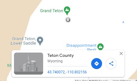
3. Click the coordinates link. Google Maps will redirect you to the coordinates and display the coordinates in DMS format.
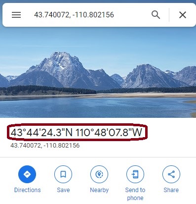
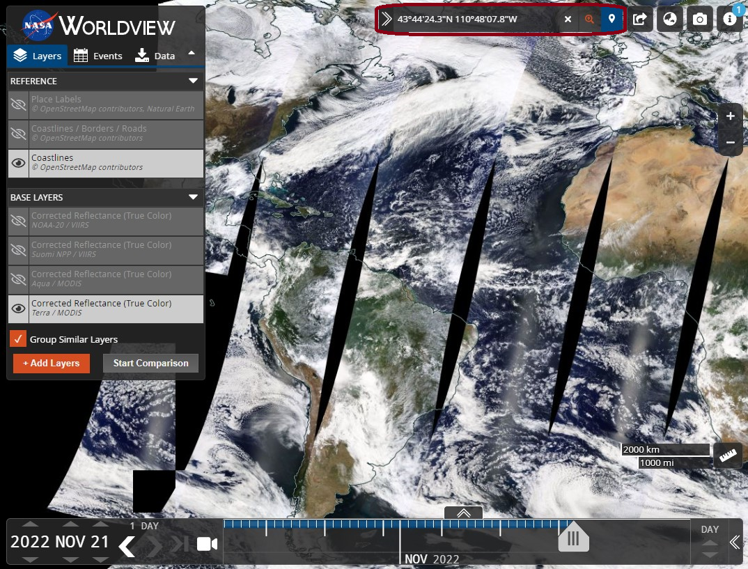
4. Copy the DMS coordinates into the WorldView's search-bar in the top-right and hit ENTER.

5. WorldView will automatically pan you to the location.
That's it!
You can now add and modify filters using the “+ Add Layers” button in the “Layers” menu.
You can also scroll historic data and imagery using the arrows on the bottom-left.
Note: Data is based on the EOSDIS satellite and will not always have imagery and data for a location on the current day because the satellite is not geostationary array and is circling the globe.
Sources
Coordinate Formats (2015). Avenza Systems. Retrieved November 21, 2022 from https://www.avenza.com/help/geographic-imager/5.0/coordinate_formats.htm.
Discover coordinates or search by latitude & longitude (2022). Google. Retrieved November 21, 2022 from https://support.google.com/maps/answer/18539?hl=en&co=GENIE.Platform%3DAndroid.
Earth Observing System Data and Information System (EOSDIS) (2021). United States Government (NASA). Retrieved November 21, 2022 from https://worldview.earthdata.nasa.gov.
Geographic coordinates conversion (2022). Wikiversity. Retrieved November 21, 2022 from https://en.wikiversity.org/wiki/Geographic_coordinate_conversion.
WorldView (2022). United States Government (NASA). Retrieved Novemeber 21, 2022 from https://worldview.earthdata.nasa.gov.